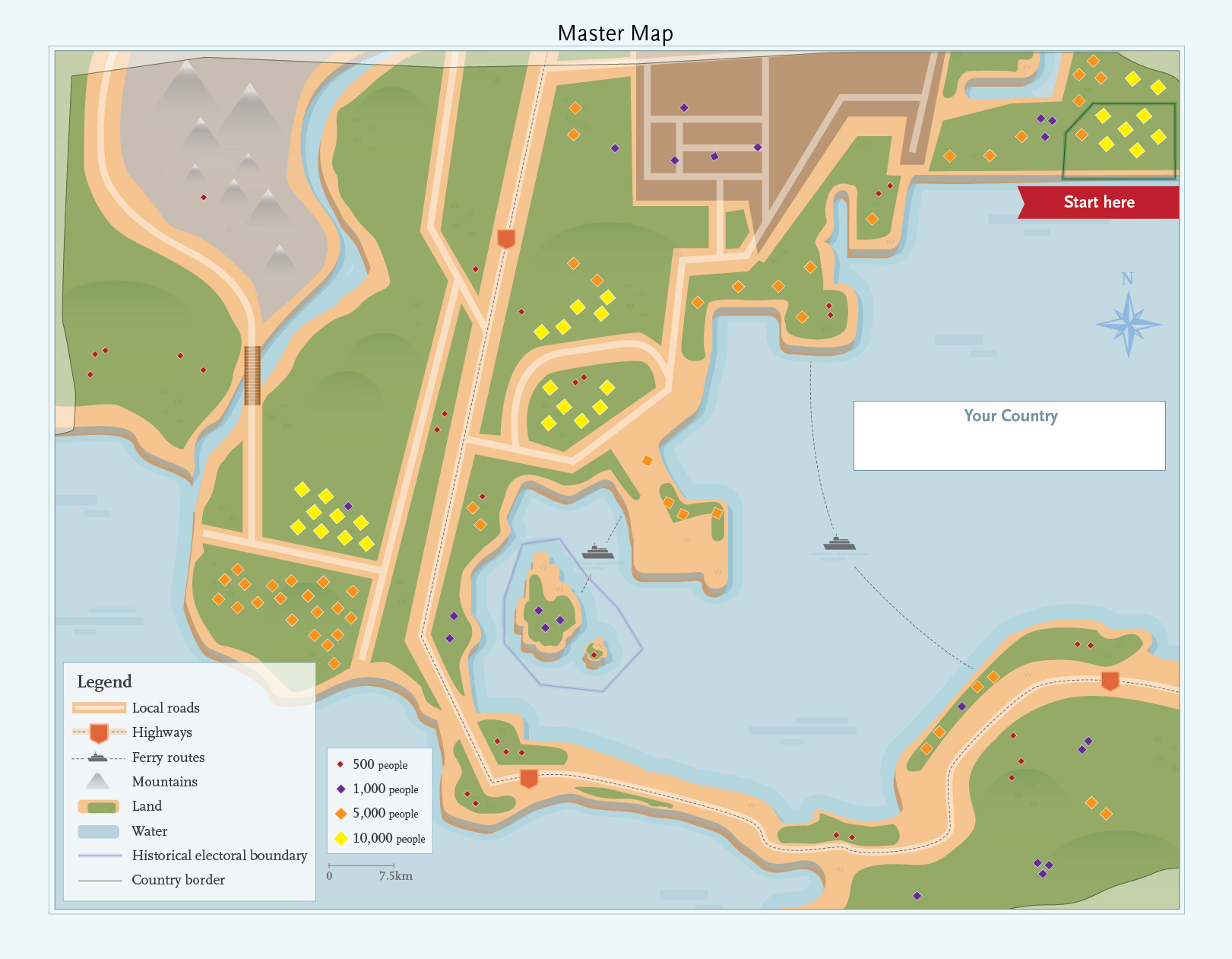
This map shows an imaginary country, with population distributed across the country. Population is represented in four sizes:
- 500 people
- 1,000 people
- 5,000 people
- 10,000 people
Geographical elements in the legend are:
- Local roads
- Highways
- Ferry routes
- Mountains
- Land
- Water
- Historical electoral boundary
- Country border
The scale of the map is 7.5km.
Students may draw their electoral boundaries on this map. One boundary has been drawn on the map, as an example for students.