Federal Electoral District Fact Sheets
-
Electoral District:
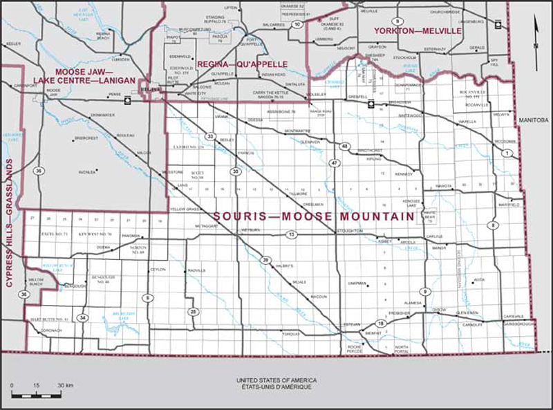
Souris—Moose MountainProvince/Territory:
Saskatchewan-
Population:
70,579 -
Area:
41,457 km² -
Population density:
2.00/km² -
Population change:
-2.8% -
Average age:
41 -
Average income:
$55,400 -
Voter turnout:
76%
Language spoken most often at home:
-
English:
66,160 -
French:
135 -
Indigenous language:
15 -
Most popular other language:
-
Tagalog (Pilipino, Filipino):
940
-
-
All others:
1,430
-
-
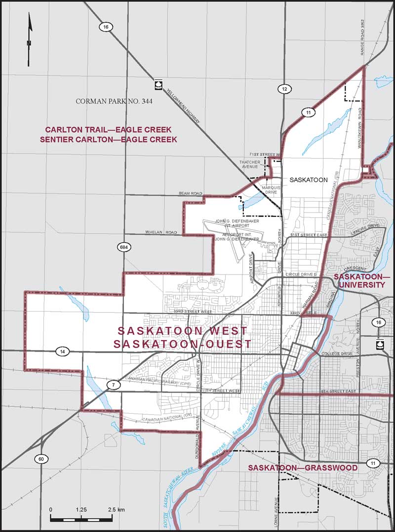
Electoral District:
Saskatoon WestProvince/Territory:
Saskatchewan-
Population:
87,855 -
Area:
91 km² -
Population density:
968.00/km² -
Population change:
+5% -
Average age:
38 -
Average income:
$45,000 -
Voter turnout:
56%
Language spoken most often at home:
-
English:
70,645 -
French:
205 -
Indigenous language:
210 -
Most popular other language:
-
Tagalog (Pilipino, Filipino):
3,365
-
-
All others:
8,005
-
-
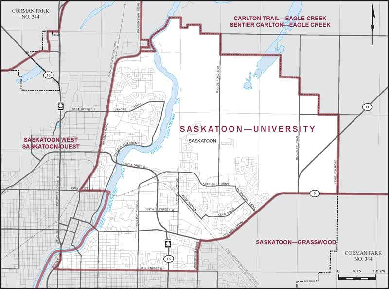
Electoral District:
Saskatoon—UniversityProvince/Territory:
Saskatchewan-
Population:
88,348 -
Area:
69 km² -
Population density:
1,286.00/km² -
Population change:
+6.9% -
Average age:
38 -
Average income:
$59,400 -
Voter turnout:
68%
Language spoken most often at home:
-
English:
74,450 -
French:
295 -
Indigenous language:
60 -
Most popular other language:
-
Mandarin:
1,835
-
-
All others:
7,580
-
-
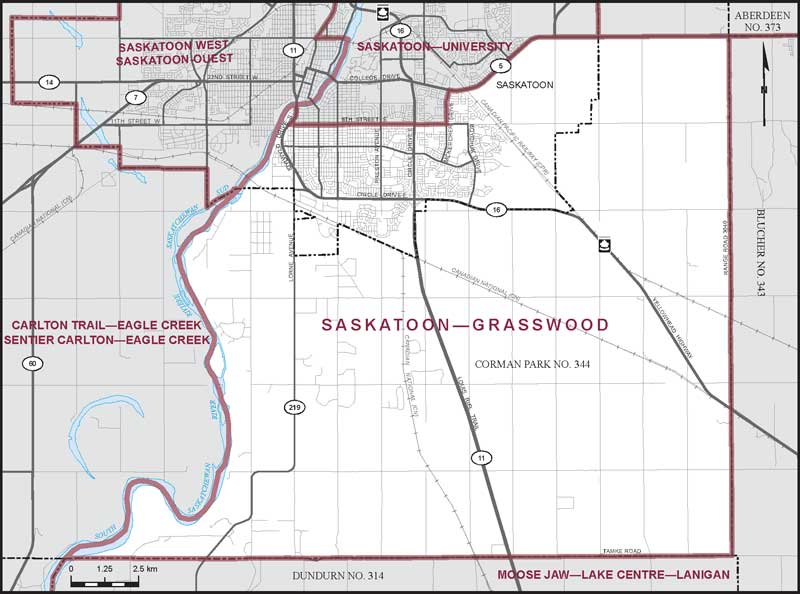
Electoral District:
Saskatoon—GrasswoodProvince/Territory:
Saskatchewan-
Population:
93,277 -
Area:
335 km² -
Population density:
278.00/km² -
Population change:
+12.5% -
Average age:
40 -
Average income:
$59,350 -
Voter turnout:
68%
Language spoken most often at home:
-
English:
78,055 -
French:
355 -
Indigenous language:
50 -
Most popular other language:
-
Mandarin:
2,235
-
-
All others:
8,235
-
-
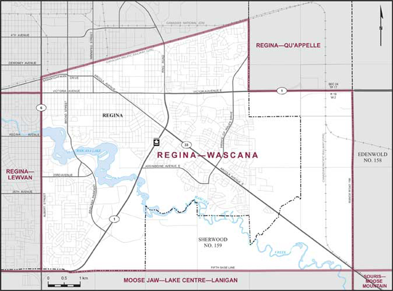
Electoral District:
Regina—WascanaProvince/Territory:
Saskatchewan-
Population:
89,087 -
Area:
62 km² -
Population density:
1,439.00/km² -
Population change:
+5.9% -
Average age:
40 -
Average income:
$58,350 -
Voter turnout:
64%
Language spoken most often at home:
-
English:
71,720 -
French:
445 -
Indigenous language:
20 -
Most popular other language:
-
Mandarin:
1,815
-
-
All others:
10,085
-
-
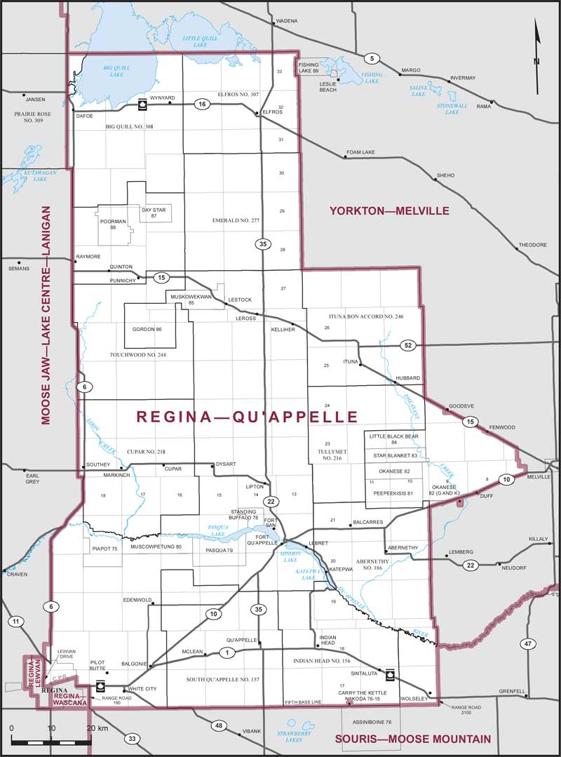
Electoral District:
Regina—Qu'AppelleProvince/Territory:
Saskatchewan-
Population:
78,140 -
Area:
12,724 km² -
Population density:
6.00/km² -
Population change:
+2.8% -
Average age:
39 -
Average income:
$49,920 -
Voter turnout:
59%
Language spoken most often at home:
-
English:
70,275 -
French:
155 -
Indigenous language:
80 -
Most popular other language:
-
Tagalog (Pilipino, Filipino):
1,010
-
-
All others:
3,540
-
-
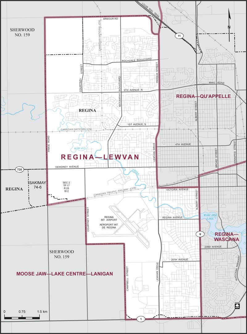
Electoral District:
Regina—LewvanProvince/Territory:
Saskatchewan-
Population:
98,492 -
Area:
58 km² -
Population density:
1,698.00/km² -
Population change:
+6.6% -
Average age:
39 -
Average income:
$59,500 -
Voter turnout:
67%
Language spoken most often at home:
-
English:
82,840 -
French:
385 -
Indigenous language:
25 -
Most popular other language:
-
Tagalog (Pilipino, Filipino):
1,785
-
-
All others:
8,590
-
-
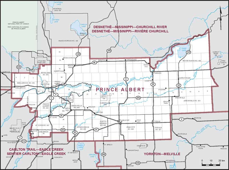
Electoral District:
Prince AlbertProvince/Territory:
Saskatchewan-
Population:
80,845 -
Area:
18,766 km² -
Population density:
4.00/km² -
Population change:
+1.5% -
Average age:
40 -
Average income:
$49,400 -
Voter turnout:
60%
Language spoken most often at home:
-
English:
72,900 -
French:
360 -
Indigenous language:
580 -
Most popular other language:
-
Tagalog (Pilipino, Filipino):
855
-
-
All others:
1,785
-
-
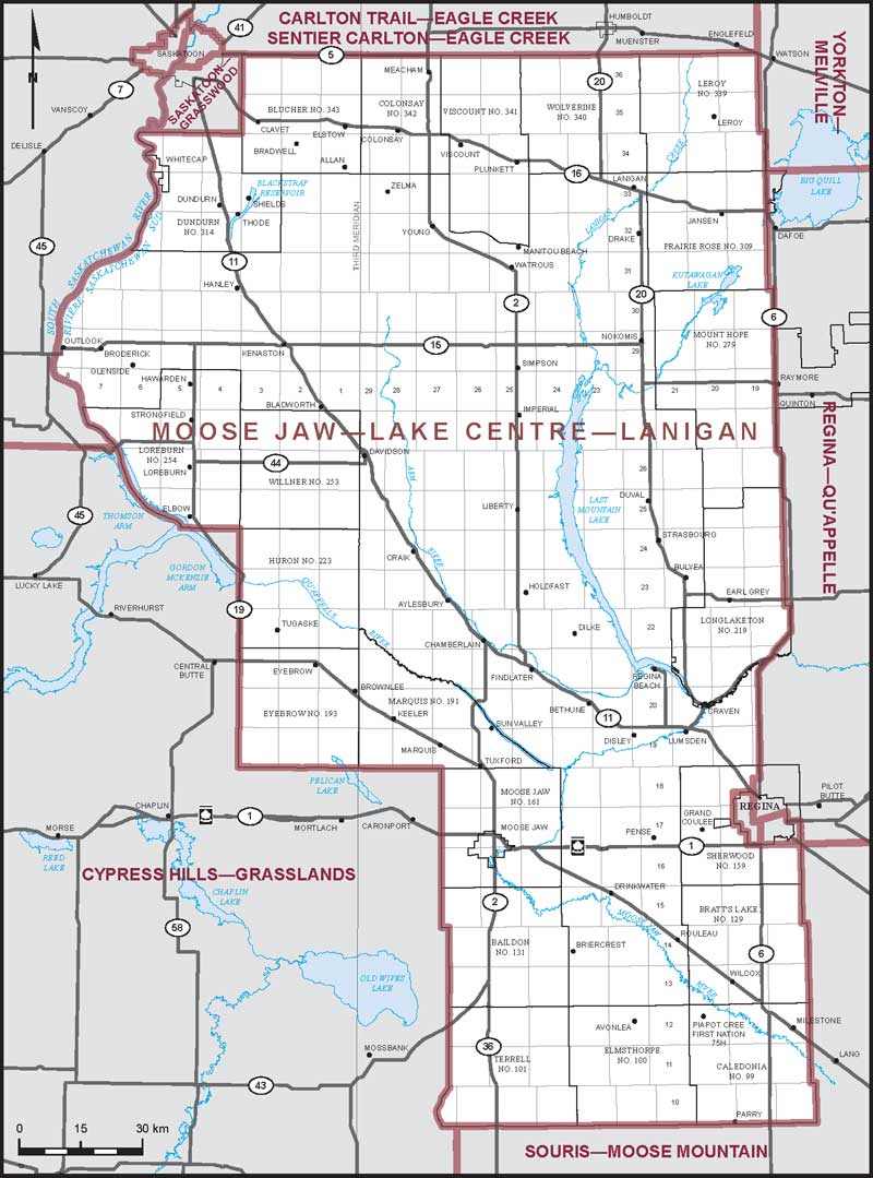
Electoral District:
Moose Jaw—Lake Centre—LaniganProvince/Territory:
Saskatchewan-
Population:
80,547 -
Area:
32,079 km² -
Population density:
3.00/km² -
Population change:
+1% -
Average age:
43 -
Average income:
$55,050 -
Voter turnout:
69%
Language spoken most often at home:
-
English:
75,540 -
French:
195 -
Indigenous language:
25 -
Most popular other language:
-
German:
700
-
-
All others:
2,195
-
-
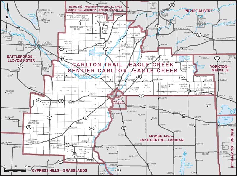
Electoral District:
Carlton Trail—Eagle CreekProvince/Territory:
Saskatchewan-
Population:
83,395 -
Area:
28,077 km² -
Population density:
3.00/km² -
Population change:
+3.4% -
Average age:
39 -
Average income:
$53,600 -
Voter turnout:
69%
Language spoken most often at home:
-
English:
77,535 -
French:
170 -
Indigenous language:
100 -
Most popular other language:
-
German:
1,425
-
-
All others:
2,000
-
-
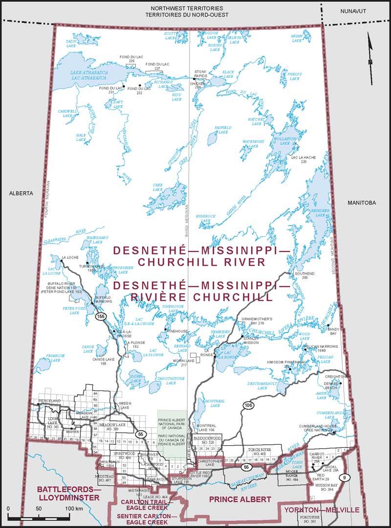
Electoral District:
Desnethé—Missinippi—Churchill RiverProvince/Territory:
Saskatchewan-
Population:
71,488 -
Area:
296,772 km² -
Population density:
0.20/km² -
Population change:
+0.8% -
Average age:
35 -
Average income:
$42,120 -
Voter turnout:
44%
Language spoken most often at home:
-
English:
59,680 -
French:
130 -
Indigenous language:
7,095 -
Most popular other language:
-
Tagalog (Pilipino, Filipino):
150
-
-
All others:
285
-
-
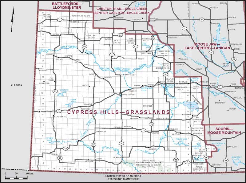
Electoral District:
Cypress Hills--GrasslandsProvince/Territory:
Saskatchewan-
Population:
68,314 -
Area:
75,611 km² -
Population density:
0.90/km² -
Population change:
-0.1% -
Average age:
43 -
Average income:
$49,400 -
Voter turnout:
69%
Language spoken most often at home:
-
English:
59,920 -
French:
230 -
Indigenous language:
30 -
Most popular other language:
-
German:
4,010
-
-
All others:
2,120
-
-
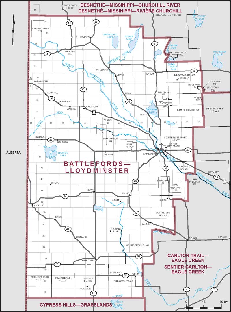
Electoral District:
Battlefords—LloydminsterProvince/Territory:
Saskatchewan-
Population:
70,918 -
Area:
29,159 km² -
Population density:
2.00/km² -
Population change:
-3.5% -
Average age:
39 -
Average income:
$49,640 -
Voter turnout:
61%
Language spoken most often at home:
-
English:
64,295 -
French:
110 -
Indigenous language:
690 -
Most popular other language:
-
Tagalog (Pilipino, Filipino):
1,075
-
-
All others:
2,270
-
-
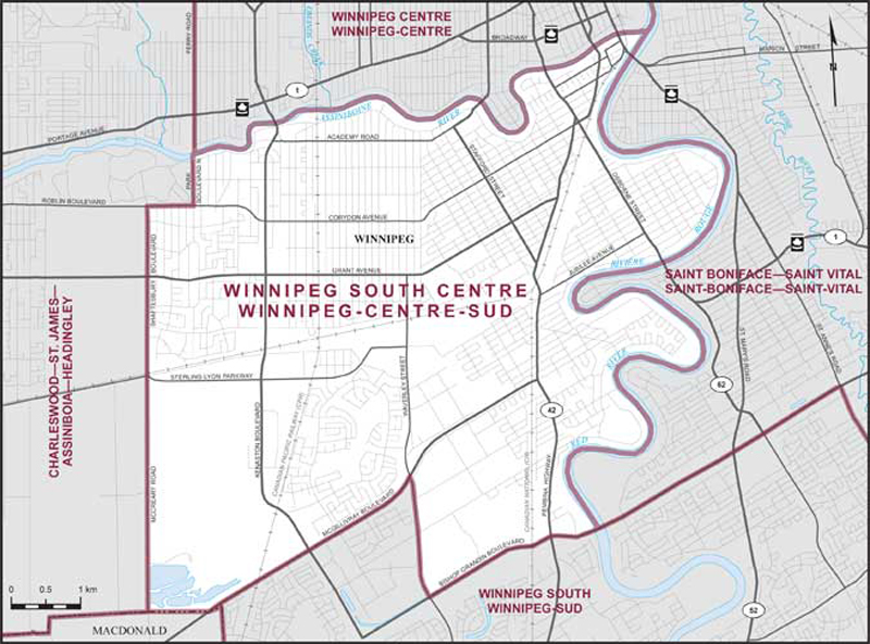
Electoral District:
Winnipeg South CentreProvince/Territory:
Manitoba-
Population:
94,803 -
Area:
45 km² -
Population density:
2,124.00/km² -
Population change:
+1.9% -
Average age:
43 -
Average income:
$63,850 -
Voter turnout:
70%
Language spoken most often at home:
-
English:
80,060 -
French:
530 -
Indigenous language:
20 -
Most popular other language:
-
Punjabi (Panjabi):
1,190
-
-
All others:
9,005
-
-
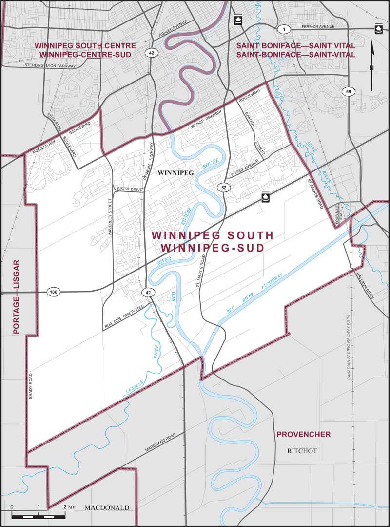
Electoral District:
Winnipeg SouthProvince/Territory:
Manitoba-
Population:
113,370 -
Area:
101 km² -
Population density:
1,120.00/km² -
Population change:
+13.7% -
Average age:
38 -
Average income:
$53,800 -
Voter turnout:
68%
Language spoken most often at home:
-
English:
77,595 -
French:
1,515 -
Indigenous language:
55 -
Most popular other language:
-
Mandarin:
6,565
-
-
All others:
19,385
-
-
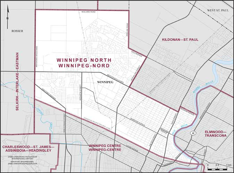
Electoral District:
Winnipeg NorthProvince/Territory:
Manitoba-
Population:
101,221 -
Area:
37 km² -
Population density:
2,707.00/km² -
Population change:
+5.8% -
Average age:
38 -
Average income:
$38,760 -
Voter turnout:
51%
Language spoken most often at home:
-
English:
61,280 -
French:
110 -
Indigenous language:
235 -
Most popular other language:
-
Tagalog (Pilipino, Filipino):
12,515
-
-
All others:
17,485
-