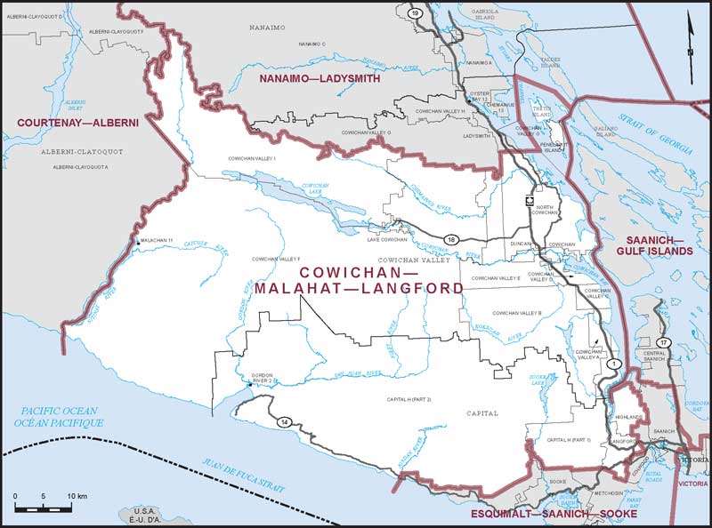
Electoral District:
Cowichan—Malahat—Langford
Province/Territory:
British Columbia
-
Population:
124,115 -
Area:
4,549 km² -
Population density:
27.00/km² -
Population change:
n/a -
Average age:
44 -
Average income:
$51,500 -
Voter turnout:
72%
Language spoken most often at home:
-
English:
117,225 -
French:
365 -
Indigenous language:
65 -
Most popular other language:
-
Punjabi (Panjabi):
605
-
-
All others:
3,570