Federal Electoral District Fact Sheets
-
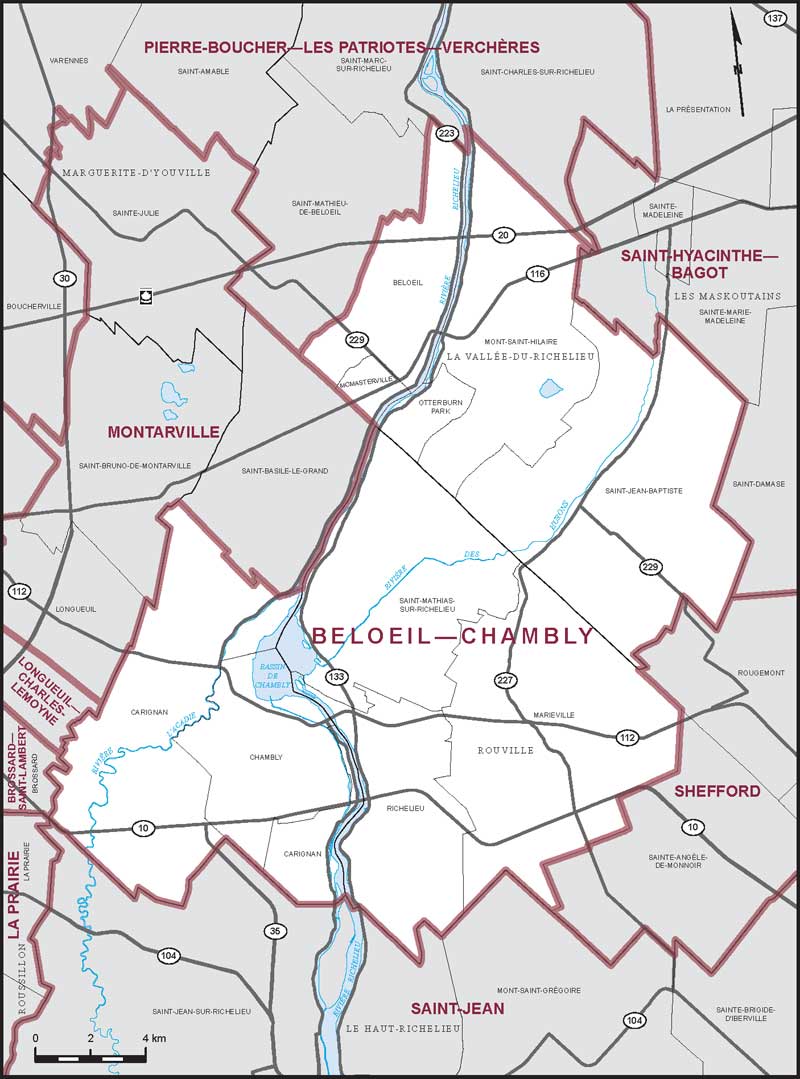
Electoral District:
Beloeil—ChamblyProvince/Territory:
Québec-
Population:
114,551 -
Area:
323 km² -
Population density:
355.00/km² -
Population change:
n/a -
Average age:
42 -
Average income:
$58,250 -
Voter turnout:
75%
Language spoken most often at home:
-
English:
3,820 -
French:
105,270 -
Indigenous language:
0 -
Most popular other language:
-
Spanish:
700
-
-
All others:
1,395
-
-
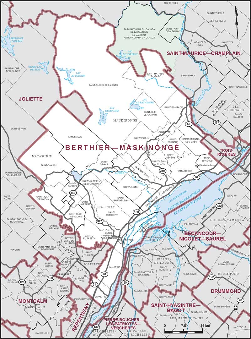
Electoral District:
Berthier—MaskinongéProvince/Territory:
Québec-
Population:
108,640 -
Area:
4,151 km² -
Population density:
26.00/km² -
Population change:
n/a -
Average age:
46 -
Average income:
$44,520 -
Voter turnout:
68%
Language spoken most often at home:
-
English:
825 -
French:
105,350 -
Indigenous language:
0 -
Most popular other language:
-
Spanish:
265
-
-
All others:
300
-
-
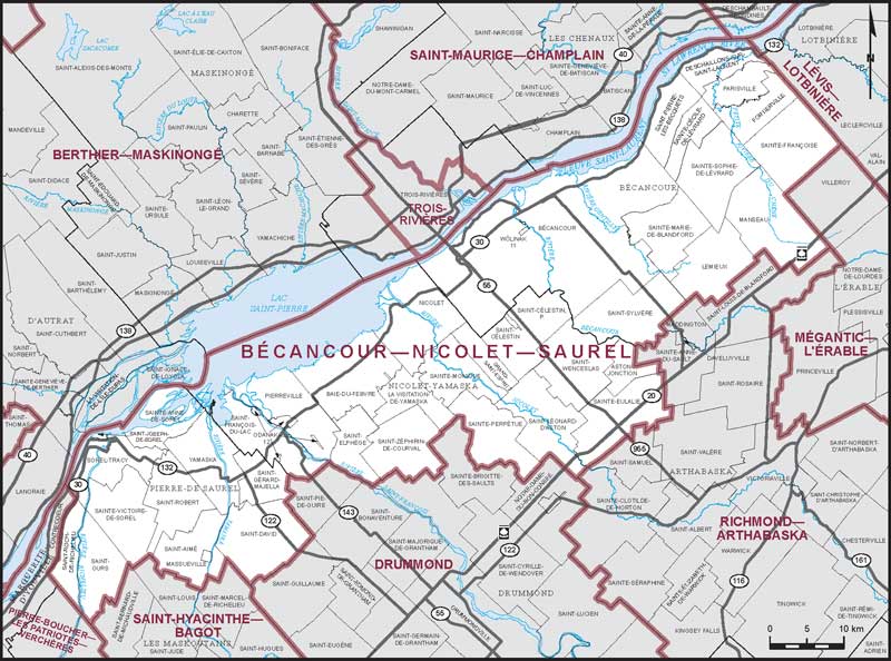
Electoral District:
Bécancour—Nicolet—Saurel—AlnôbakProvince/Territory:
Québec-
Population:
96,439 -
Area:
2,743 km² -
Population density:
35.00/km² -
Population change:
n/a -
Average age:
47 -
Average income:
$45,320 -
Voter turnout:
67%
Language spoken most often at home:
-
English:
645 -
French:
92,730 -
Indigenous language:
0 -
Most popular other language:
-
Spanish:
230
-
-
All others:
345
-
-
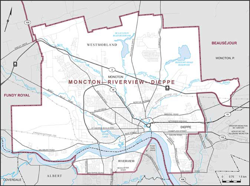
Electoral District:
Moncton—DieppeProvince/Territory:
New Brunswick-
Population:
91,961 -
Area:
160 km² -
Population density:
575.00/km² -
Population change:
n/a -
Average age:
42 -
Average income:
$46,240 -
Voter turnout:
71%
Language spoken most often at home:
-
English:
58,510 -
French:
22,285 -
Indigenous language:
0 -
Most popular other language:
-
Arabic:
885
-
-
All others:
4,690
-
-
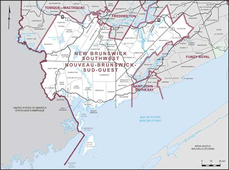
Electoral District:
Saint John—KennebecasisProvince/Territory:
New Brunswick-
Population:
81,932 -
Area:
329 km² -
Population density:
249.00/km² -
Population change:
n/a -
Average age:
43 -
Average income:
$51,550 -
Voter turnout:
70%
Language spoken most often at home:
-
English:
74,905 -
French:
1,135 -
Indigenous language:
0 -
Most popular other language:
-
Arabic:
845
-
-
All others:
2,765
-
-
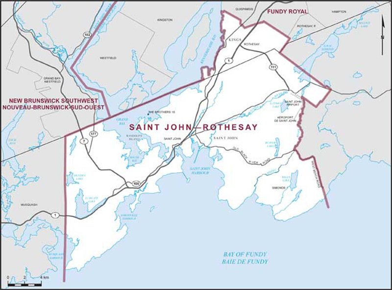
Electoral District:
Saint John—St. CroixProvince/Territory:
New Brunswick-
Population:
80,192 -
Area:
8,844 km² -
Population density:
9.00/km² -
Population change:
n/a -
Average age:
45 -
Average income:
$46,360 -
Voter turnout:
74%
Language spoken most often at home:
-
English:
76,960 -
French:
1,125 -
Indigenous language:
0 -
Most popular other language:
-
Tagalog (Pilipino, Filipino):
135
-
-
All others:
665
-
-
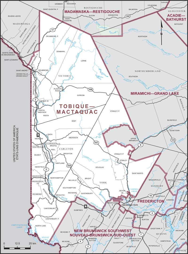
Electoral District:
Tobique—MactaquacProvince/Territory:
New Brunswick-
Population:
64,088 -
Area:
14,647 km² -
Population density:
4.00/km² -
Population change:
n/a -
Average age:
44 -
Average income:
$45,280 -
Voter turnout:
74%
Language spoken most often at home:
-
English:
61,165 -
French:
1,220 -
Indigenous language:
50 -
Most popular other language:
-
Punjabi (Panjabi):
105
-
-
All others:
815
-
-
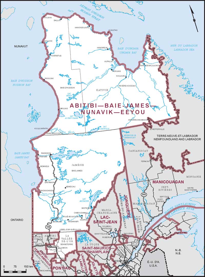
Electoral District:
Abitibi—Baie-James—Nunavik—EeyouProvince/Territory:
Québec-
Population:
89,087 -
Area:
731,401 km² -
Population density:
0.10/km² -
Population change:
n/a -
Average age:
37 -
Average income:
$53,050 -
Voter turnout:
47%
Language spoken most often at home:
-
English:
6,350 -
French:
54,405 -
Indigenous language:
23,490 -
Most popular other language:
-
Spanish:
105
-
-
All others:
315
-
-
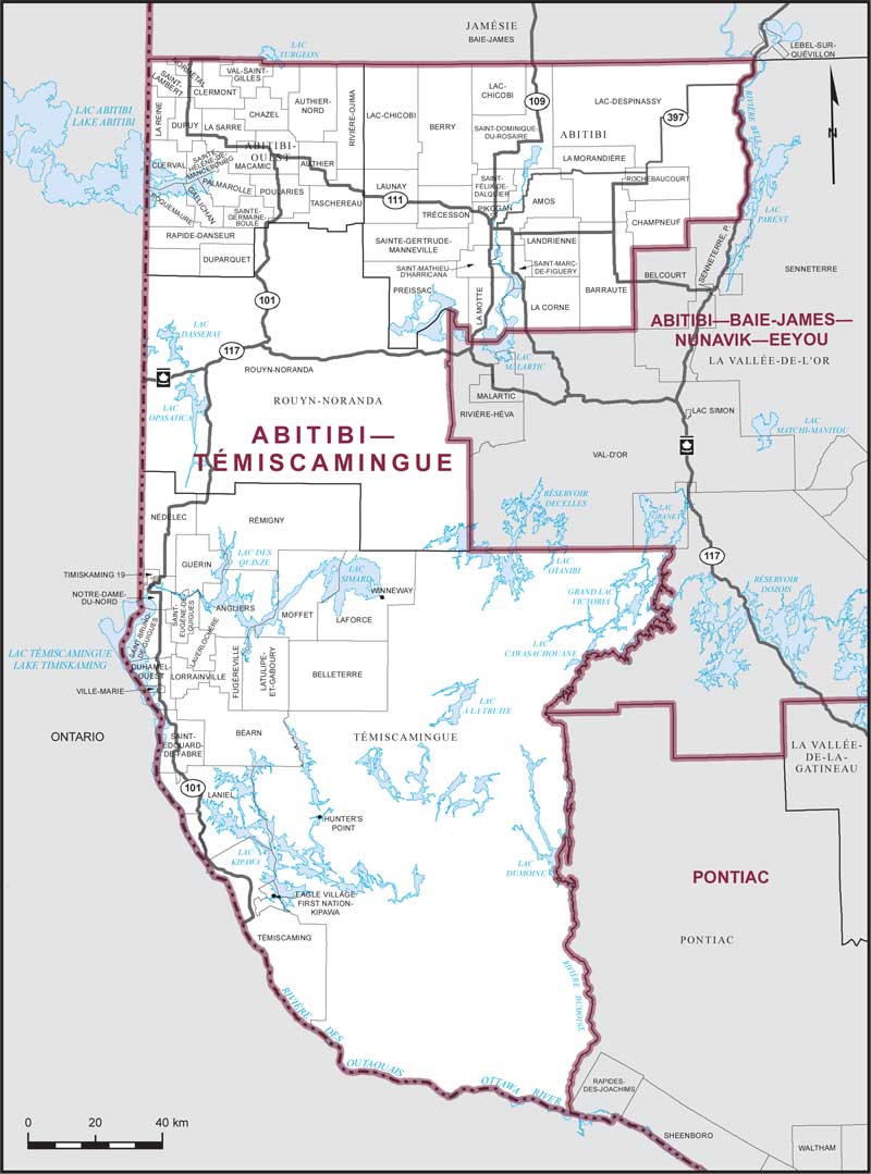
Electoral District:
Abitibi—TémiscamingueProvince/Territory:
Québec-
Population:
103,735 -
Area:
33,231 km² -
Population density:
3.00/km² -
Population change:
n/a -
Average age:
43 -
Average income:
$50,680 -
Voter turnout:
62%
Language spoken most often at home:
-
English:
3,685 -
French:
97,535 -
Indigenous language:
45 -
Most popular other language:
-
Spanish:
155
-
-
All others:
290
-
-
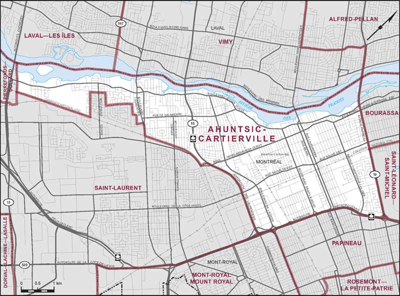
Electoral District:
Ahuntsic-CartiervilleProvince/Territory:
Québec-
Population:
111,511 -
Area:
21 km² -
Population density:
5,310.00/km² -
Population change:
n/a -
Average age:
42 -
Average income:
$50,720 -
Voter turnout:
67%
Language spoken most often at home:
-
English:
11,975 -
French:
63,110 -
Indigenous language:
0 -
Most popular other language:
-
Arabic:
6,545
-
-
All others:
16,955
-
-
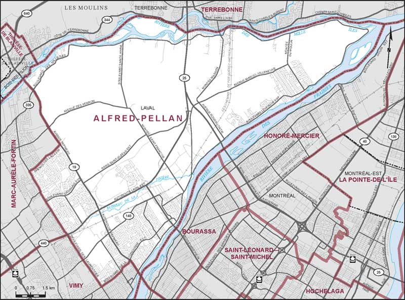
Electoral District:
Alfred-PellanProvince/Territory:
Québec-
Population:
113,173 -
Area:
116 km² -
Population density:
976.00/km² -
Population change:
n/a -
Average age:
43 -
Average income:
$53,200 -
Voter turnout:
70%
Language spoken most often at home:
-
English:
16,905 -
French:
73,535 -
Indigenous language:
0 -
Most popular other language:
-
Spanish:
3,065
-
-
All others:
10,235
-
-
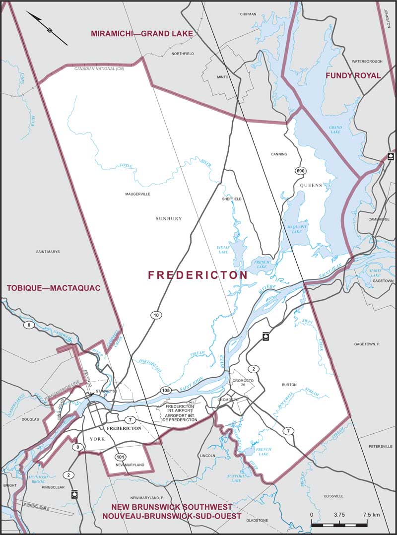
Electoral District:
Fredericton—OromoctoProvince/Territory:
New Brunswick-
Population:
85,389 -
Area:
270 km² -
Population density:
316.00/km² -
Population change:
n/a -
Average age:
41 -
Average income:
$51,700 -
Voter turnout:
75%
Language spoken most often at home:
-
English:
74,270 -
French:
3,460 -
Indigenous language:
15 -
Most popular other language:
-
Arabic:
945
-
-
All others:
3,330
-
-
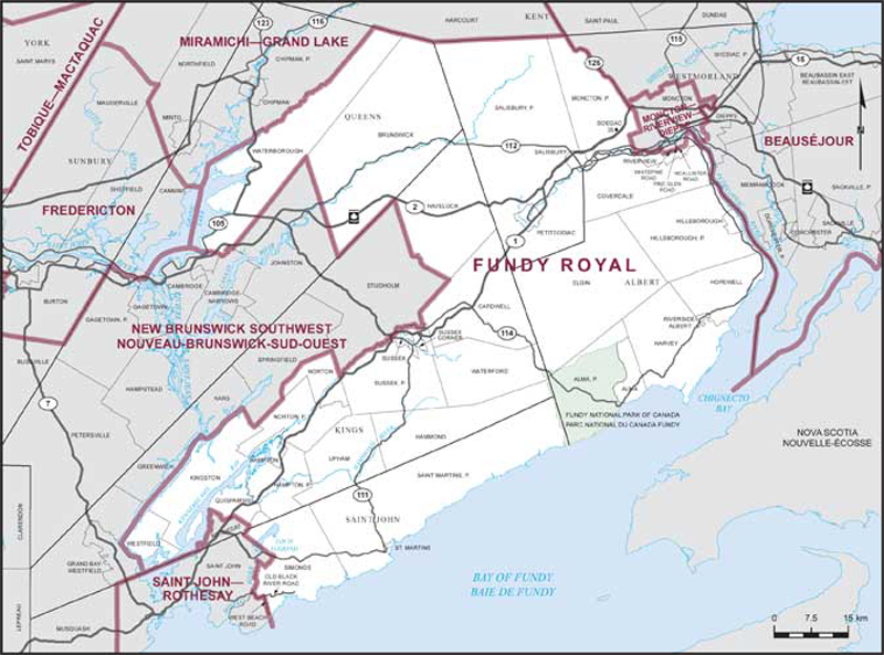
Electoral District:
Fundy RoyalProvince/Territory:
New Brunswick-
Population:
73,554 -
Area:
6,722 km² -
Population density:
11.00/km² -
Population change:
n/a -
Average age:
44 -
Average income:
$45,800 -
Voter turnout:
76%
Language spoken most often at home:
-
English:
70,290 -
French:
1,275 -
Indigenous language:
0 -
Most popular other language:
-
Korean:
90
-
-
All others:
750
-
-
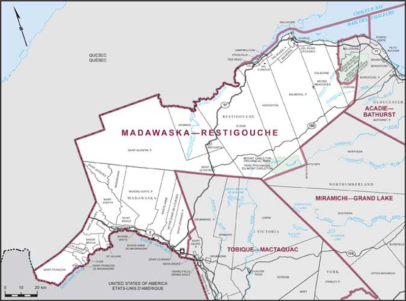
Electoral District:
Madawaska—RestigoucheProvince/Territory:
New Brunswick-
Population:
70,597 -
Area:
12,984 km² -
Population density:
5.00/km² -
Population change:
n/a -
Average age:
48 -
Average income:
$41,520 -
Voter turnout:
70%
Language spoken most often at home:
-
English:
13,845 -
French:
52,470 -
Indigenous language:
5 -
Most popular other language:
-
Punjabi (Panjabi):
85
-
-
All others:
365
-
-
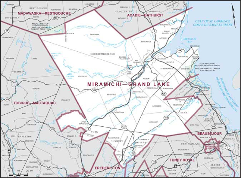
Electoral District:
Miramichi—Grand LakeProvince/Territory:
New Brunswick-
Population:
59,725 -
Area:
18,186 km² -
Population density:
3.00/km² -
Population change:
n/a -
Average age:
47 -
Average income:
$41,040 -
Voter turnout:
74%
Language spoken most often at home:
-
English:
47,970 -
French:
8,925 -
Indigenous language:
415 -
Most popular other language:
-
Tagalog (Pilipino, Filipino):
75
-
-
All others:
340
-
-
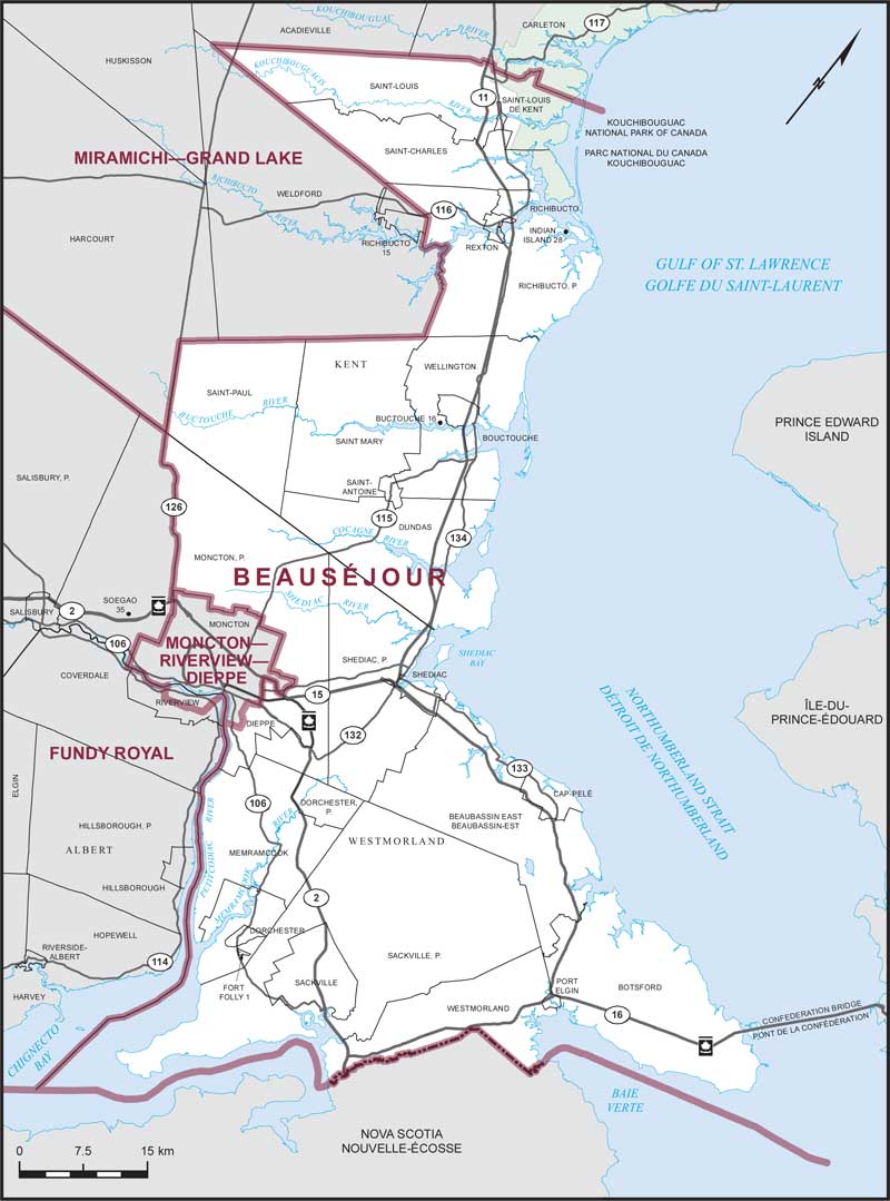
Electoral District:
BeauséjourProvince/Territory:
New Brunswick-
Population:
88,591 -
Area:
3,988 km² -
Population density:
22.00/km² -
Population change:
n/a -
Average age:
46 -
Average income:
$47,800 -
Voter turnout:
77%
Language spoken most often at home:
-
English:
35,735 -
French:
47,415 -
Indigenous language:
20 -
Most popular other language:
-
Tagalog (Pilipino, Filipino):
370
-
-
All others:
1,220
-

