Federal Electoral District Fact Sheets
-
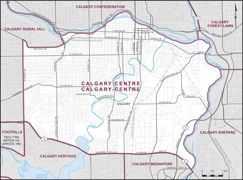
Electoral District:
Calgary CentreProvince/Territory:
Alberta-
Population:
120,536 -
Area:
45 km² -
Population density:
2,679.00/km² -
Population change:
n/a -
Average age:
39 -
Average income:
$87,700 -
Voter turnout:
69%
Language spoken most often at home:
-
English:
99,315 -
French:
865 -
Indigenous language:
15 -
Most popular other language:
-
Spanish:
1,615
-
-
All others:
13,105
-
-
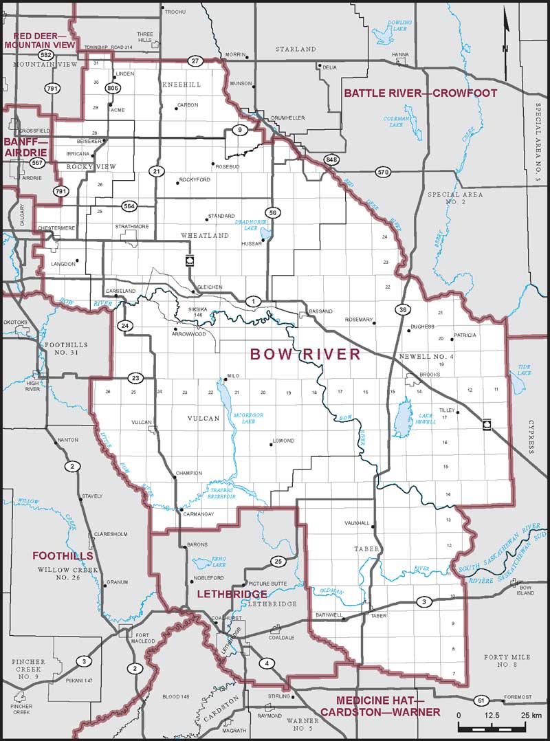
Electoral District:
Bow RiverProvince/Territory:
Alberta-
Population:
112,763 -
Area:
20,844 km² -
Population density:
5.00/km² -
Population change:
n/a -
Average age:
38 -
Average income:
$55,050 -
Voter turnout:
67%
Language spoken most often at home:
-
English:
89,205 -
French:
270 -
Indigenous language:
240 -
Most popular other language:
-
German:
5,480
-
-
All others:
11,805
-
-
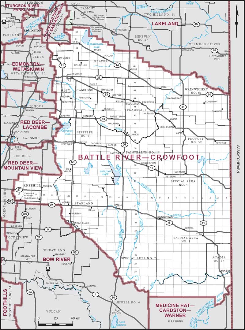
Electoral District:
Battle River—CrowfootProvince/Territory:
Alberta-
Population:
110,212 -
Area:
52,589 km² -
Population density:
2.00/km² -
Population change:
n/a -
Average age:
43 -
Average income:
$51,650 -
Voter turnout:
74%
Language spoken most often at home:
-
English:
100,590 -
French:
275 -
Indigenous language:
5 -
Most popular other language:
-
German:
3,365
-
-
All others:
2,415
-
-
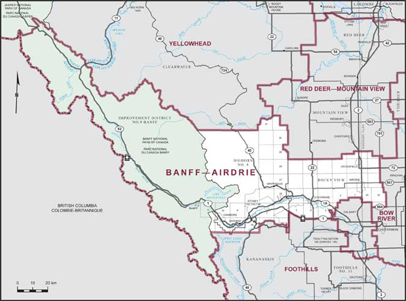
Electoral District:
Airdrie—CochraneProvince/Territory:
Alberta-
Population:
115,230 -
Area:
576 km² -
Population density:
200.00/km² -
Population change:
n/a -
Average age:
37 -
Average income:
$65,600 -
Voter turnout:
75%
Language spoken most often at home:
-
English:
104,705 -
French:
930 -
Indigenous language:
10 -
Most popular other language:
-
Punjabi (Panjabi):
1,180
-
-
All others:
5,225
-
-
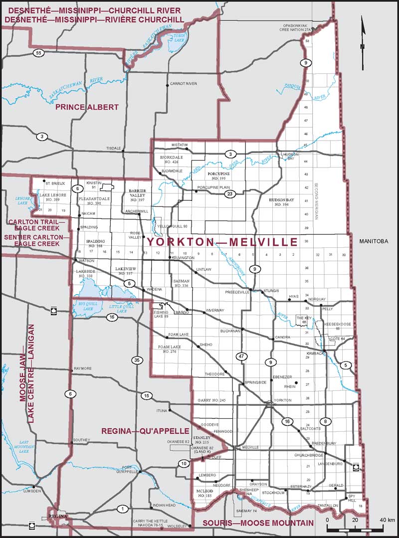
Electoral District:
Yorkton—MelvilleProvince/Territory:
Saskatchewan-
Population:
73,189 -
Area:
45,608 km² -
Population density:
2.00/km² -
Population change:
n/a -
Average age:
44 -
Average income:
$48,160 -
Voter turnout:
66%
Language spoken most often at home:
-
English:
68,665 -
French:
65 -
Indigenous language:
80 -
Most popular other language:
-
Tagalog (Pilipino, Filipino):
600
-
-
All others:
1,770
-
-
Electoral District:
Swift Current—Grasslands—KindersleyProvince/Territory:
Saskatchewan-
Population:
75,686 -
Area:
80,693 km² -
Population density:
1.00/km² -
Population change:
n/a -
Average age:
43 -
Average income:
$50,400 -
Voter turnout:
71%
Language spoken most often at home:
-
English:
66,035 -
French:
145 -
Indigenous language:
30 -
Most popular other language:
-
German:
4,945
-
-
All others:
2,345
-
-
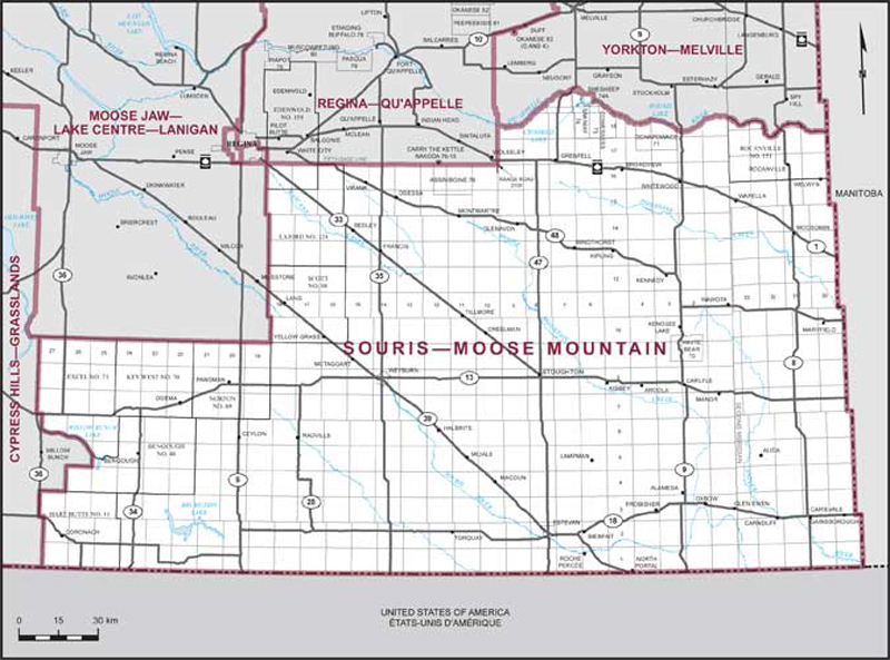
Electoral District:
Souris—Moose MountainProvince/Territory:
Saskatchewan-
Population:
75,208 -
Area:
46,646 km² -
Population density:
2.00/km² -
Population change:
n/a -
Average age:
41 -
Average income:
$54,850 -
Voter turnout:
74%
Language spoken most often at home:
-
English:
70,490 -
French:
155 -
Indigenous language:
15 -
Most popular other language:
-
Tagalog (Pilipino, Filipino):
985
-
-
All others:
1,545
-
-
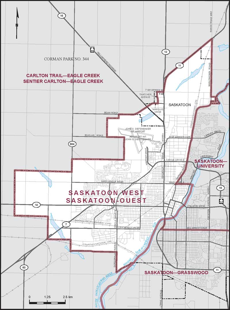
Electoral District:
Saskatoon WestProvince/Territory:
Saskatchewan-
Population:
87,865 -
Area:
106 km² -
Population density:
829.00/km² -
Population change:
n/a -
Average age:
38 -
Average income:
$46,000 -
Voter turnout:
59%
Language spoken most often at home:
-
English:
70,650 -
French:
205 -
Indigenous language:
210 -
Most popular other language:
-
Tagalog (Pilipino, Filipino):
3,365
-
-
All others:
8,010
-
-
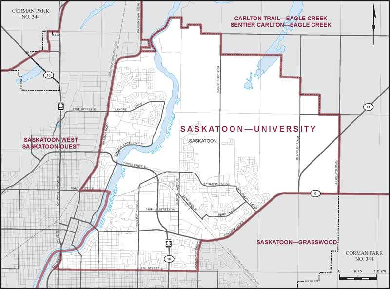
Electoral District:
Saskatoon—UniversityProvince/Territory:
Saskatchewan-
Population:
88,714 -
Area:
69 km² -
Population density:
1,286.00/km² -
Population change:
n/a -
Average age:
38 -
Average income:
$59,600 -
Voter turnout:
73%
Language spoken most often at home:
-
English:
74,795 -
French:
295 -
Indigenous language:
60 -
Most popular other language:
-
Mandarin:
1,840
-
-
All others:
7,585
-
-
Electoral District:
Saskatoon SouthProvince/Territory:
Saskatchewan-
Population:
89,562 -
Area:
52 km² -
Population density:
1,722.00/km² -
Population change:
n/a -
Average age:
40 -
Average income:
$58,200 -
Voter turnout:
72%
Language spoken most often at home:
-
English:
74,550 -
French:
335 -
Indigenous language:
45 -
Most popular other language:
-
Mandarin:
2,200
-
-
All others:
8,155
-
-
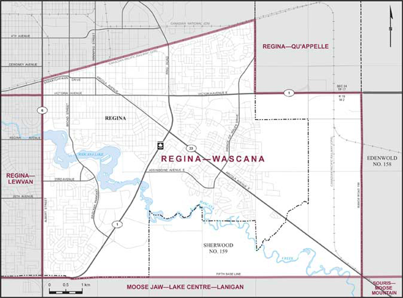
Electoral District:
Regina—WascanaProvince/Territory:
Saskatchewan-
Population:
89,063 -
Area:
52 km² -
Population density:
1,713.00/km² -
Population change:
n/a -
Average age:
40 -
Average income:
$58,350 -
Voter turnout:
70%
Language spoken most often at home:
-
English:
71,695 -
French:
450 -
Indigenous language:
25 -
Most popular other language:
-
Mandarin:
1,815
-
-
All others:
10,075
-
-
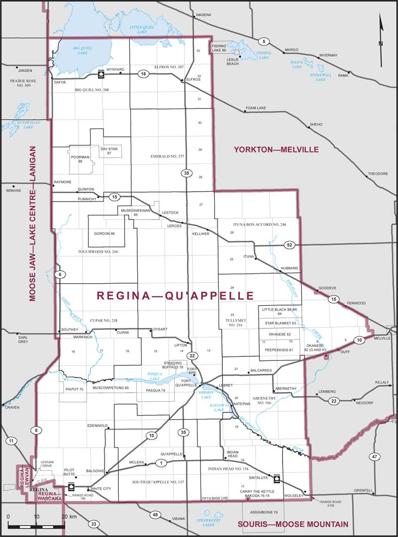
Electoral District:
Regina—Qu'AppelleProvince/Territory:
Saskatchewan-
Population:
89,275 -
Area:
12,007 km² -
Population density:
7.00/km² -
Population change:
n/a -
Average age:
39 -
Average income:
$50,400 -
Voter turnout:
65%
Language spoken most often at home:
-
English:
79,870 -
French:
180 -
Indigenous language:
85 -
Most popular other language:
-
Tagalog (Pilipino, Filipino):
1,280
-
-
All others:
4,300
-
-
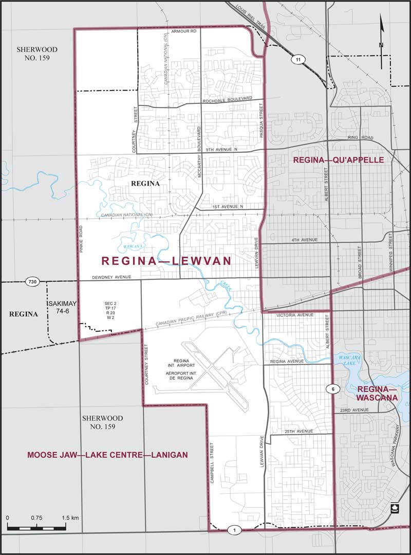
Electoral District:
Regina—LewvanProvince/Territory:
Saskatchewan-
Population:
86,899 -
Area:
83 km² -
Population density:
1,047.00/km² -
Population change:
n/a -
Average age:
39 -
Average income:
$60,350 -
Voter turnout:
72%
Language spoken most often at home:
-
English:
72,795 -
French:
355 -
Indigenous language:
15 -
Most popular other language:
-
Tagalog (Pilipino, Filipino):
1,510
-
-
All others:
7,840
-
-
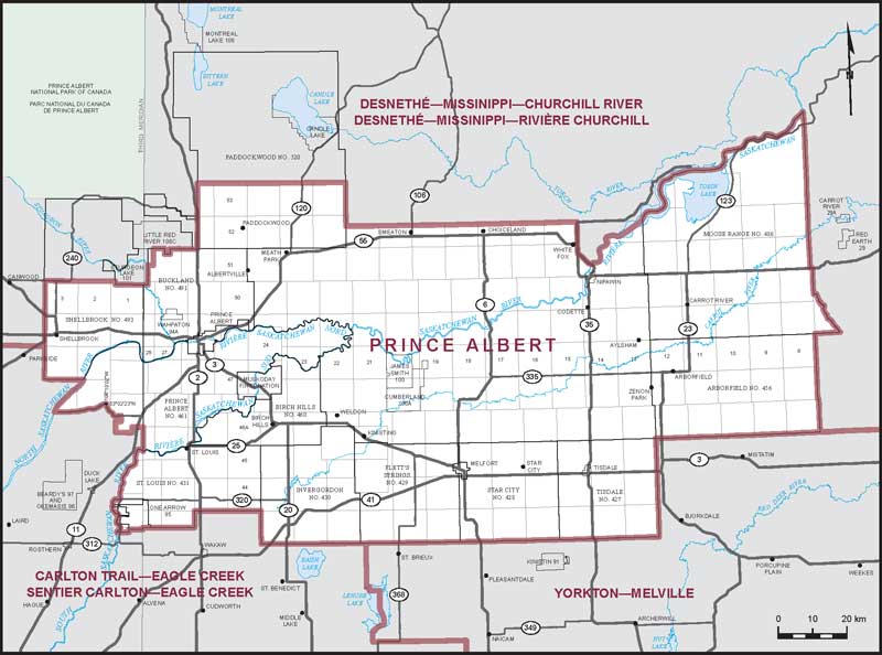
Electoral District:
Prince AlbertProvince/Territory:
Saskatchewan-
Population:
88,521 -
Area:
26,842 km² -
Population density:
3.00/km² -
Population change:
n/a -
Average age:
40 -
Average income:
$48,560 -
Voter turnout:
62%
Language spoken most often at home:
-
English:
80,295 -
French:
320 -
Indigenous language:
800 -
Most popular other language:
-
Tagalog (Pilipino, Filipino):
860
-
-
All others:
1,765
-
-
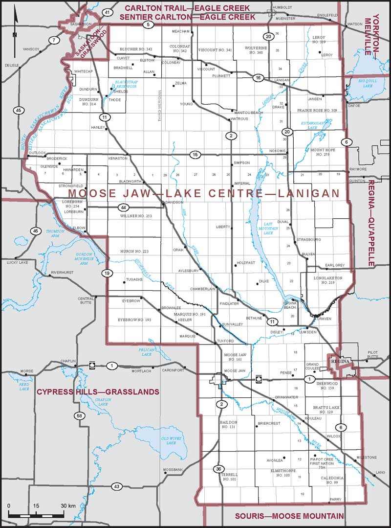
Electoral District:
Moose Jaw—Lake Centre—LaniganProvince/Territory:
Saskatchewan-
Population:
83,319 -
Area:
39,409 km² -
Population density:
2.00/km² -
Population change:
n/a -
Average age:
43 -
Average income:
$54,300 -
Voter turnout:
73%
Language spoken most often at home:
-
English:
77,940 -
French:
265 -
Indigenous language:
25 -
Most popular other language:
-
German:
760
-
-
All others:
2,285
-
-
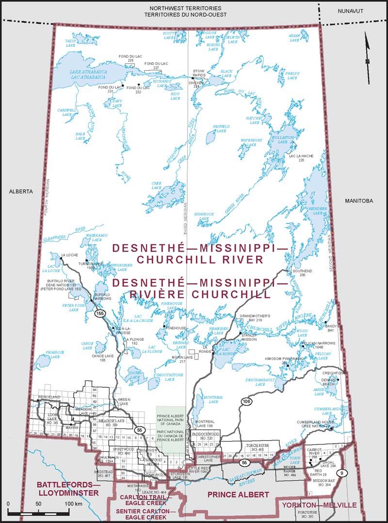
Electoral District:
Desnethé—Missinippi—Churchill RiverProvince/Territory:
Saskatchewan-
Population:
37,845 -
Area:
267,231 km² -
Population density:
0.10/km² -
Population change:
n/a -
Average age:
31 -
Average income:
$39,680 -
Voter turnout:
36%
Language spoken most often at home:
-
English:
28,015 -
French:
40 -
Indigenous language:
6,380 -
Most popular other language:
-
Tagalog (Pilipino, Filipino):
45
-
-
All others:
85
-

